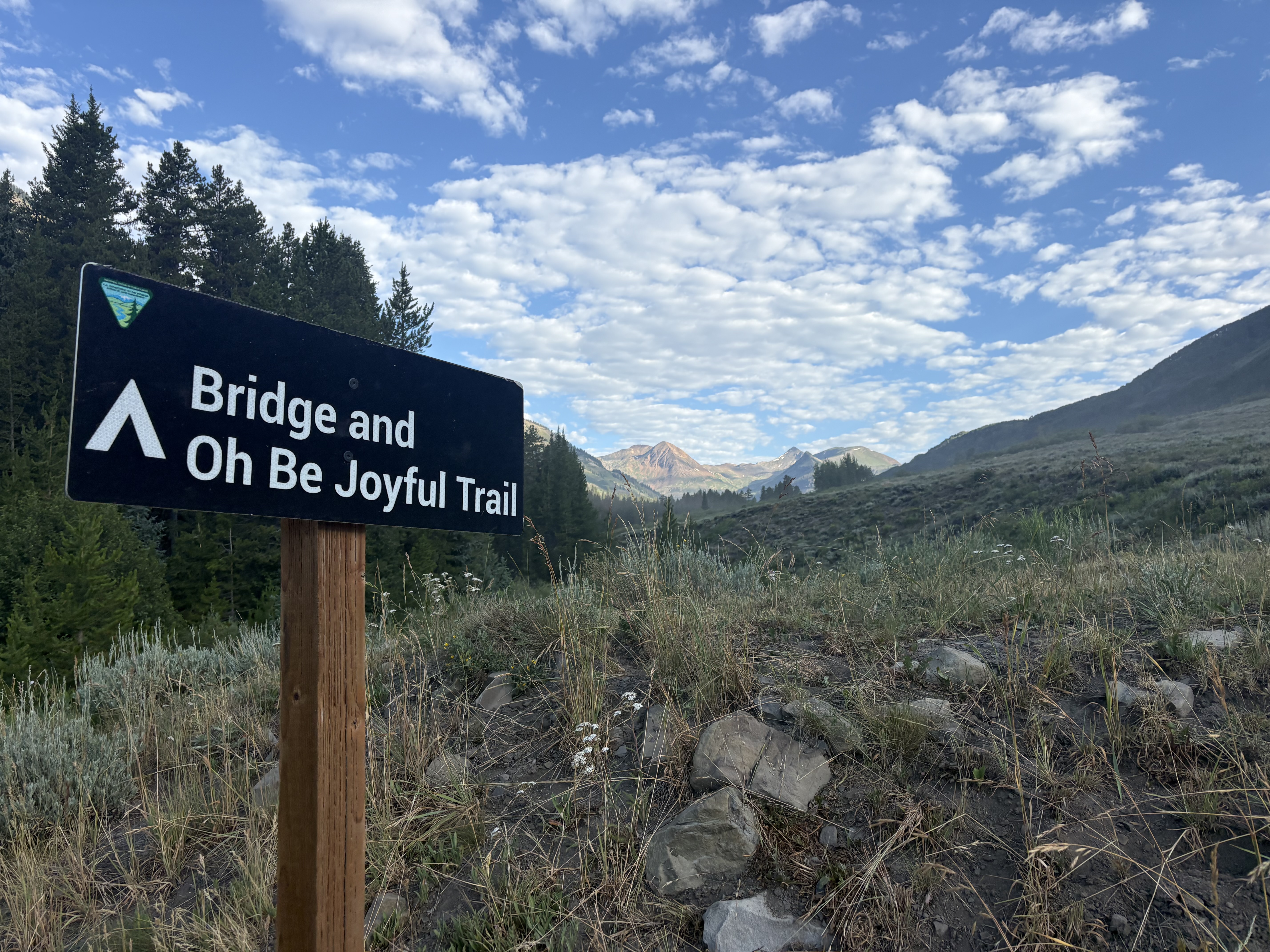
The Oh-Be-Joyful trailhead sits within a campground just outside Crested Butte, and the approach itself sets the tone: expect fellow campers sipping morning coffee next to the creek as you cross the bridge to begin. The trail follows the water, then turns uphill — and that uphill begins in earnest almost immediately.
What makes this hike different from a typical Colorado summit grind is the constant reward. Every mile brings something new: a waterfall, a meadow, a beaver pond, a meadow full of wildflowers so dense the hillsides look painted. You're not hiking toward a single payoff at the end — the payoffs stack up the whole way.
Trail Mile by Mile: What to Expect
- 0.0 mi — Trailhead — Campground & Bridge
- 0.5 mi — First waterfall & Oh-Be-Joyful valley view
- 1.0 mi — Wilderness regulations sign — dogs on leash from here
- 1.1 mi — Second waterfall — heard before seen
- 1.5 mi — Open meadow — panoramic views of peaks and cascades
- 2.0 mi — Trail changes from old road to single track — Raggeds Wilderness sign. 550 feet gained.
- 2.1 mi — Waterslide-style waterfall
- 2.9 mi — Beaver dam and beaver house along the creek
- 3.4 mi — Waterfall visible in the distance — disappears into ravine as you approach
- 4.0 mi — Green gate with no fence — walk around it
- 4.75 mi — Campsite in the trees — waterfall viewpoint at trail edge
- 5.25 mi — Trail climbs steeply again
- 5.5 mi — Daisy Pass trail split — brief flat section
- 5.6 mi — 40-foot climb to upper basin
- 7.0 mi — Blue Lake — 300 more feet gained from the basin. Actually quite green.
At roughly two miles in, the trail crosses from an old road into true wilderness. The Raggeds Wilderness sign marks the boundary — and your dogs must be on leash from here on. This is also where the landscape shifts from forested creek corridor to wide-open alpine terrain. The peaks crowd in on all sides, and the waterfalls multiply.
Past the Daisy Pass split, a short but punishing climb of 40 feet delivers you to the upper basin — and suddenly the route becomes a puzzle. Blue Lake isn't visible. It's up and to the right, hiding behind the basin's far rim. Hikers coming back down will tell you it's 'just on the top of that ridge.' They are technically correct. They are also leaving out the 300 feet of gain between you and that ridge.
How Well Do You Know This Trail?
Five questions. See how closely you read the route.
At what point does the Oh-Be-Joyful Trail transition from an old road to a single-track trail?
- At the trailhead bridge — The bridge is just the start — the trail follows old road for the first two miles before making the switch.
- About 2 miles from the trailhead — Correct. At roughly 2 miles in, the trail changes from an old road to a footpath — this is also where you enter the Raggeds Wilderness.
- Just past the Daisy Pass split — The Daisy Pass split comes much later, around 5.5 miles. The road-to-trail transition happens far earlier.
- At the upper basin — The upper basin is near mile 5.6 — well after the trail character has already changed at mile 2.
What unusual thing will you find at the 4-mile mark of the Oh-Be-Joyful Trail?
- A picnic table bolted to a boulder — No picnic tables are mentioned on this trail — but the real answer is just as unexpected.
- A green gate with no fence on either side — Correct. The trail author got a good laugh out of this one — a chained gate standing alone with no fence attached, requiring hikers to simply walk around it.
- A historic mining cabin — No cabin is mentioned at this point. The distinctive landmark here is a gate that serves no obvious purpose.
- A seasonal ranger station — There is no ranger station at this point — only the baffling fenceless gate at mile 4.
How much additional elevation do you gain between the upper basin and Blue Lake itself?
- About 40 feet — The 40-foot gain happens just after the Daisy Pass split, getting you into the upper basin — Blue Lake requires significantly more climbing beyond that.
- About 550 feet — 550 feet is the cumulative gain by the 2-mile mark — not the final push to the lake.
- About 300 feet — Correct. After crossing the upper basin, you face a steep hill with another 300 feet of gain to reach Blue Lake — hikers coming down will tell you it is 'just on the top of that ridge.'
- About 800 feet — The total gain for the full hike is 2,100 feet — the specific push from basin to lake is 300 feet.
What wildlife feature does the trail pass at approximately mile 2.9?
- An elk wallow next to a pond — No elk wallow is mentioned. Look at the creek on your left at this point for the right answer.
- A raptor nesting cliff — The wildlife highlight here is water-based, not aerial — and it involves some impressive engineering.
- A beaver dam and beaver house — Correct. Around mile 2.9, the trail author spotted a beaver dam and beaver house in the creek — followed by a series of additional beaver dams further along.
- A mountain goat grazing shelf — Mountain goats are not mentioned in the trail description. The notable wildlife feature here is in the creek itself.
Despite its name, what color is Blue Lake actually described as?
- A deep sapphire blue — That's what the name implies — but Colorado has a way of defying expectations at the summit.
- Turquoise with a milky tint — A reasonable guess for a Colorado alpine lake, but the trail author describes the color differently.
- Quite green and clear — Correct. The trail author notes that Blue Lake is 'actually quite green and clear' — worth the climb regardless of what the name promises.
- Gray-brown from glacial silt — Glacial silt lakes tend to look milky — Blue Lake is described as clear, just not the color you'd expect from the name.
That's exactly the kind of surprise that defines a great Colorado hike — you earn the final reward in stages, and the lake refuses to reveal itself until you've done the work. Once you're at the top, though, the cirque surrounding Blue Lake offers views in every direction, and the cascades tumbling down from the lake are the same water you've been following since the campground.
Whether you turn around at the first waterfall with young kids or push all the way to the upper basin, Oh-Be-Joyful lives up to its name. The valley earns that joy one mile at a time.
Which Turnaround Is Right for You?
| Family Option | Moderate Option | Full Hike | |
|---|---|---|---|
| Round Trip Miles | ~1 mile | ~4.5 miles | 14 miles |
| Turnaround Point | First waterfall | Waterslide waterfall | Blue Lake |
| Elevation Gain | Minimal | ~550 feet | 2,100 feet |
| Dogs Allowed Off-Leash | Yes | Leash required after ~1 mi | Leash required after ~1 mi |
| Waterfalls Seen | 1 | 2-3 | 5+ |
| Beaver Dams Possible | No | No | Yes, near mile 2.9 |
| Blue Lake View | No | No | Yes |
Your Visit Checklist for Oh-Be-Joyful
- Start early — especially on weekends — The campground fills up and the trail gets busy. Morning hikers get the creek-side coffee ambiance and cooler temps for the steep sections.
- Cross the bridge first — Look for the sign at the trailhead that reads 'bridge and trail' — this is your starting point. The trail begins on the far side of the bridge through the campground.
- Leash your dog after the first mile — A wilderness regulations board around the one-mile mark requires dogs on leash from that point forward. Plan ahead if you're bringing a pet.
- Photograph the 3.4-mile waterfall early — A waterfall visible at 3.4 miles disappears into a ravine as you approach. Take your photo when you first spot it — you won't get a better angle.
- Don't be fooled by the flat stretch near mile 5 — The trail flattens briefly before the Daisy Pass split — but the steepest climbing of the day comes right after. Eat something and hydrate at this rest point.
- Pick your lunch spot at the lake — The cirque view is great from the middle of the lake or either end. Give yourself at least 30 minutes at the top before the return trip.
Trail Details & Contact
- Oh-Be-Joyful Trail to Blue Lake: Located near Crested Butte, Colorado. Trailhead includes bathrooms, signage, and a campground with creek access.
- Full Hike: 14 miles, 2,100 feet of gain: Shorter turnaround options available at 1 mile (family) and 4.5 miles (moderate hikers).
- Dogs on leash required: Leash rules apply inside the Raggeds Wilderness boundary, beginning around the 1-mile mark.
- Questions or hike suggestions?: Email trail author Deb Stanley at HikingDebbie@gmail.com or follow more hikes on Facebook at Facebook.com/DenverHikingExaminer