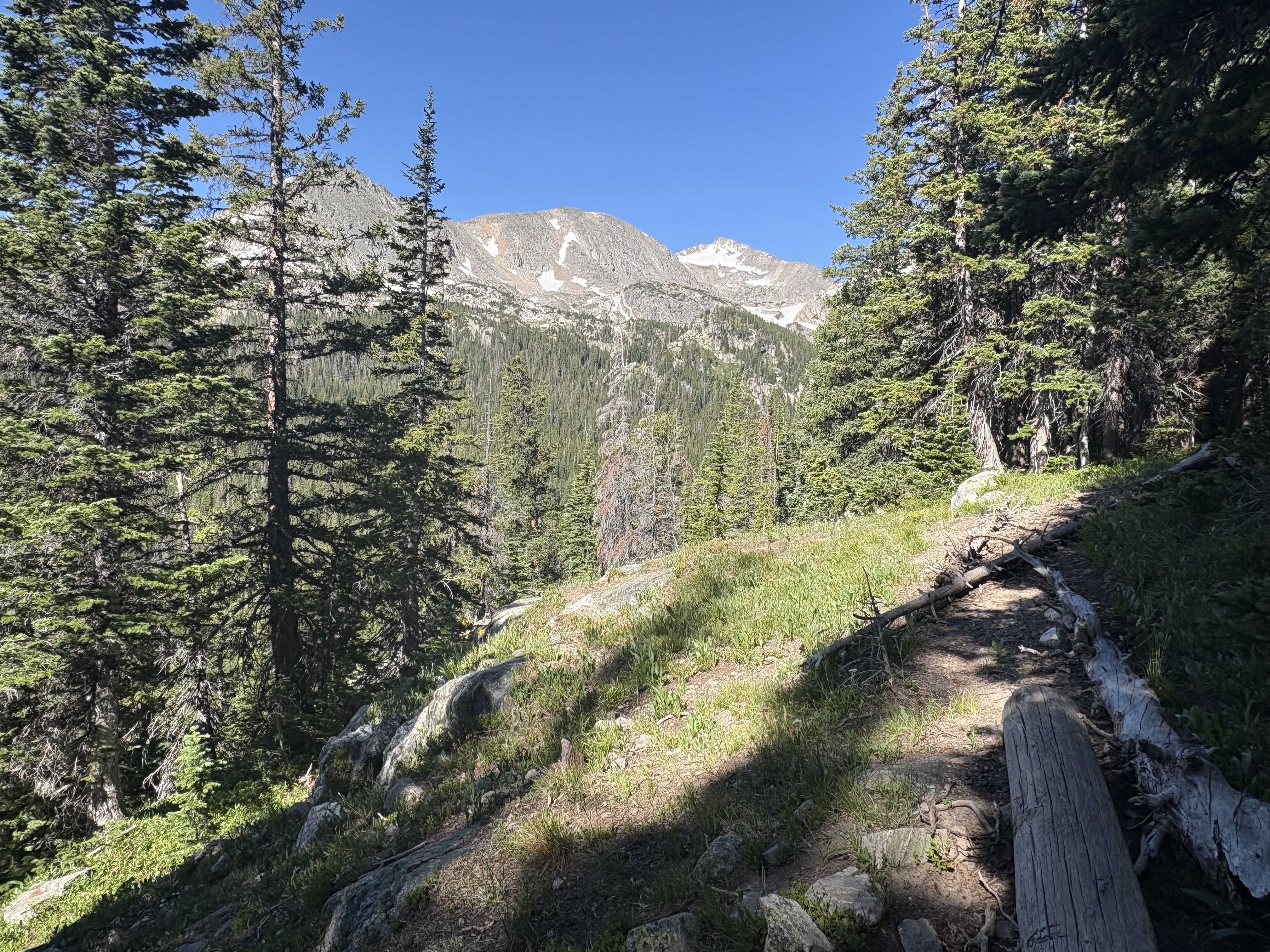
Getting to the Diamond Lake trailhead is its own small adventure. The Fourth of July Trailhead sits four miles past the Hessie Trailhead on a rough dirt road that typically only opens in summer and isn't suited for every vehicle. When you pass the Hessie Trailhead and see a long column of parked cars stretching down the road, you'll know you're on the right track — and that arriving early really does matter.
At the trailhead itself, you'll find a small campground, pit toilets, and signage explaining Indian Peaks Wilderness rules. One of those signs will tell you Diamond Lake is two miles away. It's closer to three.
Your Trail — Mile by Mile
- Mile 0 — Fourth of July Trailhead — 10,000 ft
- Mile 0–1.25 — Arapahoe Pass Trail No. 904 — immediate uphill through forest and boardwalks
- Mile 1.25 — Trail split — turn LEFT for Diamond Lake. Right goes to Arapahoe Pass, Lake Dorothy, the Fourth of July mine, and Caribou Lake.
- Mile ~1.75 — Unnamed waterfall — worth the stop, especially when wildflowers are blooming creekside. Cross the bridge and turn LEFT.
- Mile ~2.75 — Diamond Lake Travel Zone sign — you're close. Watch for the fork: turn RIGHT for the lake, LEFT continues to Jasper Lake.
- Mile ~2.9 — Lower Diamond Lake — 10,940 ft. Rocky perches in the trees for lunch; rocks by the shore for sun.
- Beyond — Upper Diamond Lake, Jasper Lake — trails become faint. Use AllTrails or COTREX maps.
The trail splits personality around the 1.25-mile mark. Before it, you're climbing steadily through forest on Arapahoe Pass Trail No. 904, the elevation gain relentless from the first step. After the split toward Diamond Lake, the trail relaxes into a rolling section through the trees — a welcome surprise after all that uphill work.
Then comes the waterfall. It doesn't appear on maps with a name, which is probably why it catches hikers off guard. When wildflowers are in peak bloom along the creek bank, it's one of the most photogenic spots in the entire Indian Peaks Wilderness. Cross the bridge, turn left, and prepare for one more sustained climb — about 350 additional feet of elevation gain over the final mile to the lake.
What's at Each Destination
| Lower Diamond Lake | Upper Diamond Lake | Jasper Lake | |
|---|---|---|---|
| Distance from trailhead | ~2.9 miles | Beyond lower lake | Past Diamond Lake Trail junction |
| Elevation | 10,940 ft | Higher than 10,940 ft | See trail signs |
| Trail clarity | Clear and signed | Faint — easy to lose | Via Diamond Lake Trail |
| Map required? | Recommended | Yes — AllTrails or COTREX | Yes — AllTrails or COTREX |
| Shoreline character | Marshy with rocky lunch spots | Alpine | Alpine |
| Peak views | Mt. Neva (12,814 ft), Mt. Jasper (12,923 ft) | Open alpine | Open alpine |
How Ready Are You for Diamond Lake?
Five questions. Find out where your gaps are before you go.
The Fourth of July Trailhead parking area can fill as early as what time on a busy summer day?
- 9 a.m. — By 9 a.m. the lot has been full for hours. The parking area can fill before 7 a.m. — an earlier start isn't just recommended, it's often required.
- Before 7 a.m. — Correct — and it's one of the most important planning facts for this hike. The lot fills before sunrise on popular summer days.
- Noon — Noon is far too late to count on a spot. The lot can be full before 7 a.m. — plan accordingly.
- Parking is unlimited — Parking is limited and a real constraint. The Fourth of July Trailhead serves hikers heading to Diamond Lake and other Indian Peaks destinations — spots go fast.
The trailhead sign says Diamond Lake is 2 miles away. What is the actual distance?
- 2 miles — the sign is accurate — The sign is off by about a mile. Diamond Lake is actually closer to 3 miles from the trailhead — and the full round trip to Lower Diamond Lake is 5.8 miles.
- About 3 miles — Right — the sign says 2, but the real distance is closer to 3 miles each way. This is the most common planning mistake hikers make on this trail.
- About 4 miles — Not quite — it's closer to 3 miles one way, making the full Lower Diamond Lake hike 5.8 miles round trip with 1,100 feet of total elevation gain.
- Under 2 miles — it's easier than the sign says — The trail is actually longer than the sign suggests. Diamond Lake is closer to 3 miles from the trailhead — plan your water and food accordingly.
At the 1.25-mile trail split, which direction do you turn for Diamond Lake?
- Right — toward Arapahoe Pass — Going right takes you toward Arapahoe Pass, Lake Dorothy, the Fourth of July mine, and Caribou Lake — all great destinations, but not Diamond Lake. Turn left at the split.
- Left — toward Diamond Lake — Correct. The left fork is your route to Diamond Lake. The right fork heads toward Arapahoe Pass and beyond — useful to know if you're planning a future trip to Caribou Lake or Lake Dorothy.
- Straight — the trail doesn't split — There is a real split at 1.25 miles — and taking the wrong fork means a very different hike. Left is Diamond Lake; right goes to Arapahoe Pass and Lake Dorothy.
- Either direction eventually reaches the lake — The two forks go to distinct destinations. Only the left fork leads to Diamond Lake — the right one heads toward Arapahoe Pass and Caribou Lake.
Near Diamond Lake, a confusing junction shows two arrows — one labeled 'Diamond Lake' and one labeled 'Diamond Lake Trail.' Which do you follow to reach the lake itself?
- Follow 'Diamond Lake Trail' — it sounds more official — This is the intuitive-but-wrong answer. The 'Diamond Lake Trail' arrow points toward Jasper Lake and other points beyond. To reach the lake, follow the 'Diamond Lake' arrow — which points right.
- Follow 'Diamond Lake' — turn right — Correct. The 'Diamond Lake' arrow points right and takes you to the lake and its campsites. The 'Diamond Lake Trail' continues on to Jasper Lake and other destinations.
- Both arrows go to the same place — They split to different destinations. The 'Diamond Lake' arrow (right) takes you to the lake; the 'Diamond Lake Trail' arrow (left) continues toward Jasper Lake.
- The article says to turn left at this junction — Turn right here, not left. The left fork picks up the Diamond Lake Trail toward Jasper Lake. Following the 'Diamond Lake' arrow to the right leads you to the lake and its campsites.
What tool does the trail strongly recommend for navigating to Upper Diamond Lake?
- Trail markers are sufficient — just follow the signs — The trail to Upper Diamond Lake is described as faint and easy to lose — trail markers alone aren't reliable here. Bring a digital map from AllTrails and/or COTREX.
- A printed paper map from a ranger station — Not a bad instinct, but the trail specifically recommends a map from AllTrails and/or COTREX, which offer current trail data and GPS tracking for the faint upper route.
- A map from AllTrails and/or COTREX — Right — these are specifically called out for the upper route because the trail beyond Lower Diamond Lake is faint and easy to lose. Download the maps before you lose cell service.
- No map needed — the upper trail is well-marked — The upper trail is the opposite of well-marked — it's described as faint and easy to lose. AllTrails and COTREX are specifically recommended before attempting it.
Diamond Lake sits in a natural bowl at 10,940 feet, ringed by peaks that remind you exactly how high you've climbed. The shoreline itself is marshy — don't expect a clean sandy edge — but rocky outcroppings tucked into the trees create natural lunch spots, and flat rocks at the water's edge are ideal for warming up after the final push.
That's where the trail's misleading sign finally makes sense. The outflow from Diamond Lake is visible from the valley below as a waterfall on the hillside — one of the landmarks hikers notice on the way up and don't quite understand until they're standing at the lake looking back down.
The Peaks Above Diamond Lake
- 12,923 — Mount Jasper
- 12,814 — Mount Neva
- 10,940 — Diamond Lake
- 10,000 — Trailhead
Your Diamond Lake Visit Checklist
- Leave before sunrise — The Fourth of July Trailhead lot can fill before 7 a.m. on summer weekends. Arrive early or risk driving back without hiking.
- Plan for 3 miles each way, not 2 — The trailhead sign says 2 miles. The real distance to the lake is closer to 3, with a full round trip of 5.8 miles and 1,100 feet of gain.
- Download your maps before you go — AllTrails and COTREX both cover this area. Cell service fades on the approach road — download offline maps at home.
- Know your two key junctions — At 1.25 miles, turn LEFT for Diamond Lake (not right toward Arapahoe Pass). Near the lake, follow the 'Diamond Lake' arrow RIGHT — not the 'Diamond Lake Trail' arrow left toward Jasper Lake.
- Stop at the waterfall — The unnamed waterfall about half a mile past the trail split has no name on any map, but it's worth every minute — especially when wildflowers are blooming at the creek bank.
- Keep dogs leashed at all times — Wilderness rules at the Fourth of July Trailhead require dogs on leash throughout the Indian Peaks Wilderness. Signs at the trailhead spell it out clearly.
Other Destinations From This Trailhead
The trail split at 1.25 miles is a genuine fork in your adventure. Hikers who turn right instead of left toward Diamond Lake can reach Arapahoe Pass, Lake Dorothy, the Fourth of July mine (the source of the trailhead's name), and Caribou Lake — all within the Indian Peaks Wilderness.
Beyond Lower Diamond Lake, the Diamond Lake Trail continues to Jasper Lake and other high alpine destinations. These upper routes require navigation skills and current maps from AllTrails or COTREX because the trails become faint. Both Upper Diamond Lake and Jasper Lake reward experienced hikers who are comfortable navigating without well-defined trail markers.
Plan Your Visit
- Getting There: Google 'Fourth of July Trailhead.' It sits four miles past the Hessie Trailhead — when you see parked cars lining the road at Hessie, you're on track.
- Trail Maps: Download offline maps on AllTrails or COTREX before leaving home — cell service disappears on the approach road.
- Hike Suggestions & Questions: Have a trail to recommend? Contact the author directly.
- More Great Hikes: Find additional Colorado hiking guides at the author's Facebook page.